Skip to content
Unveiling the Magnificence of Sangay National Park
Sangay National Park, a treasure trove of natural wonders, boasts three captivating attractions: active volcanoes, enchanting lakes with intriguing stories, and an extensive biodiversity that has earned it UNESCO’s recognition as a World Natural Heritage Site since 1983. Let’s delve into the allure of this majestic park, situated in the Eastern Cordillera.

Sistema Nacional de Áreas Protegidas (2011)
Volcanic Marvels: Sangay, Tungurahua, and Altar
Sangay: The Southernmost Active Volcano
Sangay, standing proudly at 5,230 metres, is the southernmost active volcano in the northern volcanic zone. Its perfect cone shape is a striking feature, and the name “Sangay” originates from the Shuar term “Samkay,” meaning “to scare away”. Continuously erupting since 1934, Sangay remains one of the most active volcanoes globally, adding an element of awe to the park’s landscape.

Foto: Ministerio del Ambiente (s,f)
Tungurahua: The Fiery Giant
In stark contrast, Tungurahua, at 5,016 metres, has been erupting violently since August 1999. The name “Tungurahua” derives from the Kichwa words “tungur” (throat) and “rauray” (burning). Its eruptions include powerful explosions, pyroclastic flows, and lava flows, creating a dynamic spectacle within the park.
Altar: The Sublime Mountain
Altar, also known as Cápac Urcu, stands at 5,319 metres and is the only dormant volcano among the trio. Its indigenous name translates to “sublime mountain”, reflecting its serene beauty. Altar’s last eruption shaped a remarkable agora of rocky peaks, making it a visual delight for nature enthusiasts.

Foto: Ministerio de Turismo (2020)
Cultural Tapestry: Inhabitants and Historical Footprints
Sangay National Park is not only a natural marvel but also a repository of cultural history. In the mountainous regions, descendants of the Cañari and Puruhá peoples reside, while the jungle areas are home to the Shuar nationality. The park’s diverse topography served as a historical crossroads, with pre-Inca and pre-Columbian vestiges hinting at past civilisations.
Andean Road System: Qhapaq Ñan
The Andean Road System, or Qhapaq Ñan, traverses the park, showcasing ancient paths from the pre-Hispanic era. This ancestral route passes through the Achupallas area, Culebrillas lagoon, and on to the ruins of Ingapirca, providing a glimpse into the region’s rich history.

Foto: El Universo (2020)
Biodiversity Extravaganza: Flora and Fauna
Diverse Ecosystems: Paramos to Subtropical Zones
Sangay National Park’s exceptional biodiversity is evident in its varied ecosystems, ranging from paramos and high Andean forests to subtropical forests. The park hosts over 3,000 plant species, including 586 unique to the area, such as the exquisite orchids numbering around 250. From mosses in the cloud forests to aquatic plants in the humid paramo, each zone contributes to the park’s ecological richness.
Wildlife Haven: Jaguars, Bears, and Exotic Birds
The park shelters a diverse array of wildlife, including Andean bears, mountain tapirs, pumas, and a multitude of bird species. With over 107 mammal species, 400 birds, 90 amphibians, 26 reptiles, and 17 fish, Sangay National Park stands as a haven for nature enthusiasts and researchers alike.
Explore Sangay: Trails and Activities
Scenic Trails and Natural Wonders
Sangay National Park offers several trails for adventurers seeking to explore its beauty:
- Ozogoche Trail: A 2-kilometre path leading to the Ozogoche lagoons, showcasing the park’s natural splendour.
- Laguna Amarilla del Altar: A 12-kilometre trail to the Altar volcano, offering medium to advanced difficulty levels. For summit exploration, a specialised mountain guide is recommended.
- Qhapaq Ñan: An ancient trail from the pre-Hispanic era, crossing the paramo and revealing archaeological sites along its route.
- Sardinayacu: An 8-kilometre trail leading to the natural viewpoint of Sangay, providing breathtaking vistas.
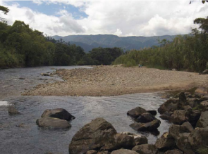
- Arrayanes Forest: A 3-kilometre trail along the Upano River and the Volcan River to the Sardinas River, offering activities like kayaking, fishing, and rafting.
Embark on a journey to Sangay National Park, where nature’s wonders and cultural richness intertwine, creating an experience like no other. Explore the trails, witness volcanic majesty, and immerse yourself in the vibrant tapestry of biodiversity that defines this UNESCO-acclaimed sanctuary.