Unveiling the Beauty of Hydrographic Basins
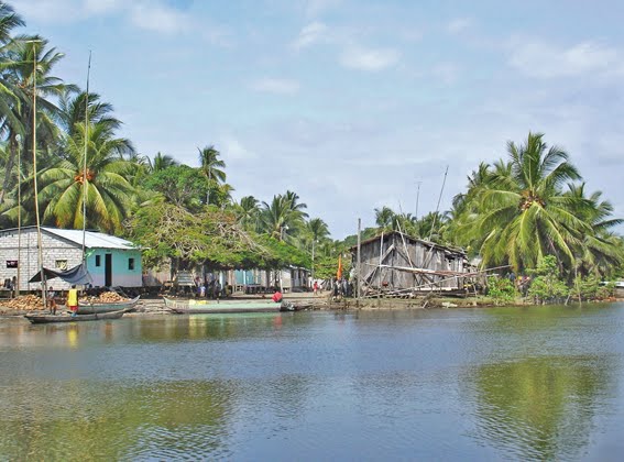
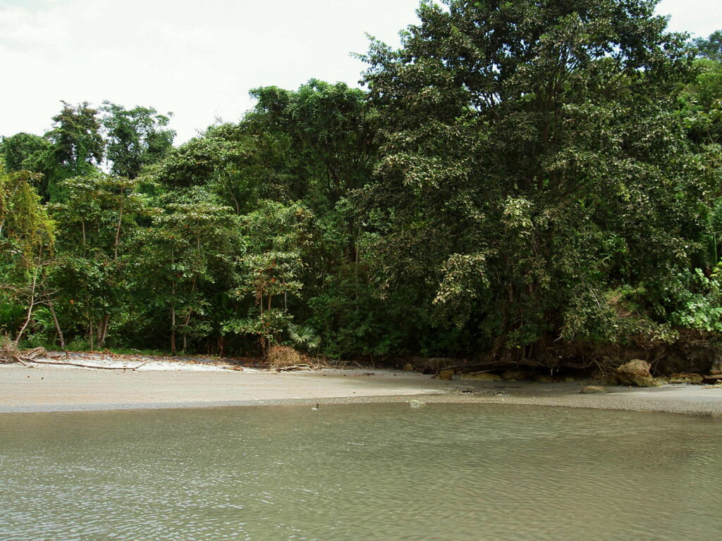
Nestled in the northwest of the country, the Manglares Cayapas Mataje Ecological Reserve stands as a guardian of two vital hydrographic basins: the Mataje river to the north and the Cayapas to the south. These basins, shared with Colombia, define the essence of this protected haven. The reserve encapsulates a unique delta system at the confluence of the Cayapas and Mataje rivers, adorned with estuaries, channels, islands, islets, sandbanks, and diverse beaches.
The Unique Climate and Biodiversity
One distinctive feature of this area is the consistent warmth, with temperatures ranging between 26°C and 29°C throughout the year. This stable climate fosters an environment supporting the largest mangrove trees globally, reaching up to 60 metres in height. The abundance of nutrients and climatic stability contributes to this extraordinary phenomenon.
Guardian of Biodiversity and Tradition
Beyond its natural wonders, the reserve serves as a protector of mangroves. These flourish in the estuary formed by the Cayapas and Slaughter rivers in the north of Esmeraldas province. This protection extends to safeguarding both the rich biodiversity and the ancestral traditions of neighbouring communities. For these communities, the mangrove swamp is not just a natural spectacle but a lifeline.
Journey Through the Delta
As the Cayapas and Mataje rivers flow into the Pacific Ocean, a delta adorned with islands, islets, and channels unfolds, constituting a significant portion of the reserve. The protected area seamlessly transitions into mainland ecosystems, known as “guandales,” and finally into the lush tropical humid forest.
Discover the Majagual Interpretation Centre
Situated within the reserve is the Majagual Interpretation Centre, offering insights into the diverse ecosystems. The primary hiking trail, the “Long Way – House of Pargo”, spans 6.5 kilometres, providing a medium-difficulty exploration of the landscapes and wildlife. River tours such as La Mongonera-La Trocha, Honey – Pichangal, Sta. Rosa – El Bajito, Guachal – The Shortcuts, and Changuaral-Rubber offer immersive experiences in the mangrove swamp, all requiring the guidance of knowledgeable experts.
Unveiling Ancient Marvels
In the midst of the lush reserve and its surroundings, the echoes of La Tolita, a pre-Hispanic culture adept in metal casting, resonate. Over two thousand years ago, La Tolita thrived in this region, showcasing unparalleled creativity in metal designs and mastery in casting techniques. The Tolita – Tumaco metallurgy, renowned for its exquisite gold and platinum casting, stands as a testament to human ingenuity.
A Story of Conservation
The 1980s marked a challenging period for Ecuador’s mangroves, facing severe threats from uncontrolled shrimp pools. In response, the Ecuadorian State declared the mangroves an Ecological Reserve in 1995. In that way, it safeguarded the environment but also the livelihoods of Afro-Ecuadorian communities reliant on the mangrove’s resources.
The Enchanting Mangroves and Their Labyrinths
The heart of the reserve lies in the enchanting mangroves at the river mouths. Adapted to the blend of fresh and saltwater, these mangroves form labyrinths connected by channels and estuaries. These serve as pathways to towns like San Lorenzo, Borbón, La Tola, and Valdez (Limones). Notable mangrove channels include El Pailón, Boca de Mataje, and Bolívar, with Majagual standing out near San Lorenzo.
Bird Island: Nature’s Spectacle
Opposite the Bolívar channel, a sanctuary awaits – Bird Island. Here, thousands of pelicans, herons, seagulls, blue-footed boobies, patillos, and frigates find refuge, creating a mesmerising spectacle.
La Tolita Archaeological Site
Adding to the allure is the La Tolita archaeological site, unveiling vestiges of a culture that thrived between 500 BCE to 500 CE. Tolas, small elevations covering tombs with ceramics, gold, and platinum jewellery, offer a glimpse into the rituals surrounding life and the afterlife.
Hydrographic Marvels
The primary hydrographic basins, formed by the Cayapas and Mataje rivers, extend into estuaries and channels, vital natural subsystems crucial for the ecological and economic sustenance of local populations in the buffer zone.
In essence, the Manglares Cayapas Mataje Ecological Reserve stands not only as a haven for biodiversity but as a testament to the harmonious coexistence of nature and culture, where preservation meets exploration in the heart of Ecuador’s ecological treasures.