Nestled amidst the grand Andes Mountains lies the breathtaking Los Ilinizas Ecological Reserve. The reserve is home to two twin peaks that originated from a single ancient volcano. The soils of the reserve are of recent volcanic origin, which adds to the unique character of this awe-inspiring destination.
Diverse Ecosystems in the Ilinizas
The Ilinizas boasts two distinct areas owing to the high altitudes of the peaks. The western part of the reserve has moist soils and vegetation due to the humidity from the Pacific Ocean. On the other hand, the inter-Andean soils on the foothills facing the alley have less water and are sandy. This phenomenon of clouds being hindered by mountains is known as a “rain shadow”, where one side of the mountain is humid while the other is dry.
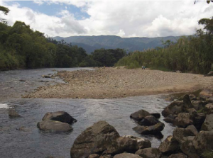
The reserve is home to several other peaks, including the Corazón volcano and Quilotoa, a crater lagoon that is the reserve’s most famous attraction. Additionally, two essential rivers, Toachi and Pilaton, originate from the foothills of Los Ilinizas Ecological Reserve. The reserve’s cloud forests play a vital role in water generation for the neighbouring towns and cities.
Exploring Los Ilinizas Ecological Reserve
The Los Ilinizas Ecological Reserve is divided into four sections. The largest section lies to the west of Quilotoa, where the streams and springs that feed into the Toachi River are located. The second section is located to the northeast, housing the Ilinizas and Corazón peaks. The third section, separated from the larger section by the Latacunga – The Manna highway, lies to the southwest. The fourth section is an 800-hectare island that surrounds the Quilotoa lagoon.
History and Culture of Los Ilinizas Ecological Reserve
The ancient history of the region reveals the presence of ethnic groups such as Chibchas, Cayapas-Tsáchila, and Quijos, who came from the Coast and the Amazon. The name Iliniza appears to have come from the Kunza words for “masculine hill”. Before the arrival of the Incas, the region was divided into various chiefdoms such as Tacunga, Mulliambato, Píllaro, Quisapincha, and Panzaleo. During the colonial period, vast haciendas emerged particularly in the Andean zone. Some of these are still maintained and dedicated to agriculture and livestock, along with peasant and indigenous communities.
Biodiversity in Los Ilinizas Ecological Reserve
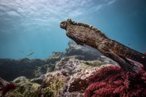
Los Ilinizas Ecological Reserve is home to subtropical forests, Andean forests, and páramos, and is recognised for its remarkable biodiversity. The subtropical forests that occupy the reserve are home to many mammals, including ocelots, armadillos and cusumbos. Additionally, there is a wide range of birds that inhabit the forest, including tanagers, nuthatches and hummingbirds. The puma, a large cat that inhabits the subtropical forests, can climb up to the moors just like the spectacled bear. The Andean forests are the habitat of a rare and endangered mammal, the pacarana, also known as the guanta con cola. It is a medium-sized, nocturnal rodent that builds its burrow at the base of large trees. The páramos and high areasare inhabited by the páramo wolf and the white-tailed deer.
The cloud forests inside the reserve provide a natural refuge for many species, particularly birds. Turkeys, partridges, toucans, hummingbirds, and pygmy owls or Ecuadorian owls, which measure just 16 centimetres, are just some of the many bird species that can be observed in these forests. The tororoi, a squat, long-legged bird that forages for insects in the forest floor, is also present. The yellow-eared parrot is one of the unique and critically endangered birds that has been registered in the reserve. It builds its roosts and nests in the trunks of wax palms, which are increasingly scarce due to their use during Holy Week.
Vegetation in Los Ilinizas Ecological Reserve
The vegetation in the Ilinizas Ecological Reserve is diverse and striking. In the warmer areas, there are palms such as the chonta and the tagua, as well as matapalos, porotones, and giant ferns. Higher up there are romerillo and cedar trees, highly valued for their wood, as well as myrtle and lime trees. In the páramos, there are forests of paper trees, chuquiraguas, pajonales, chochos de monte, and mortiños. These mix with expanses of bare sand, giving a lunar aspect to the landscape. Around the Quilotoa lagoon, there are chilcas, little shoes, milkmen, and cacti.
Ilinizas
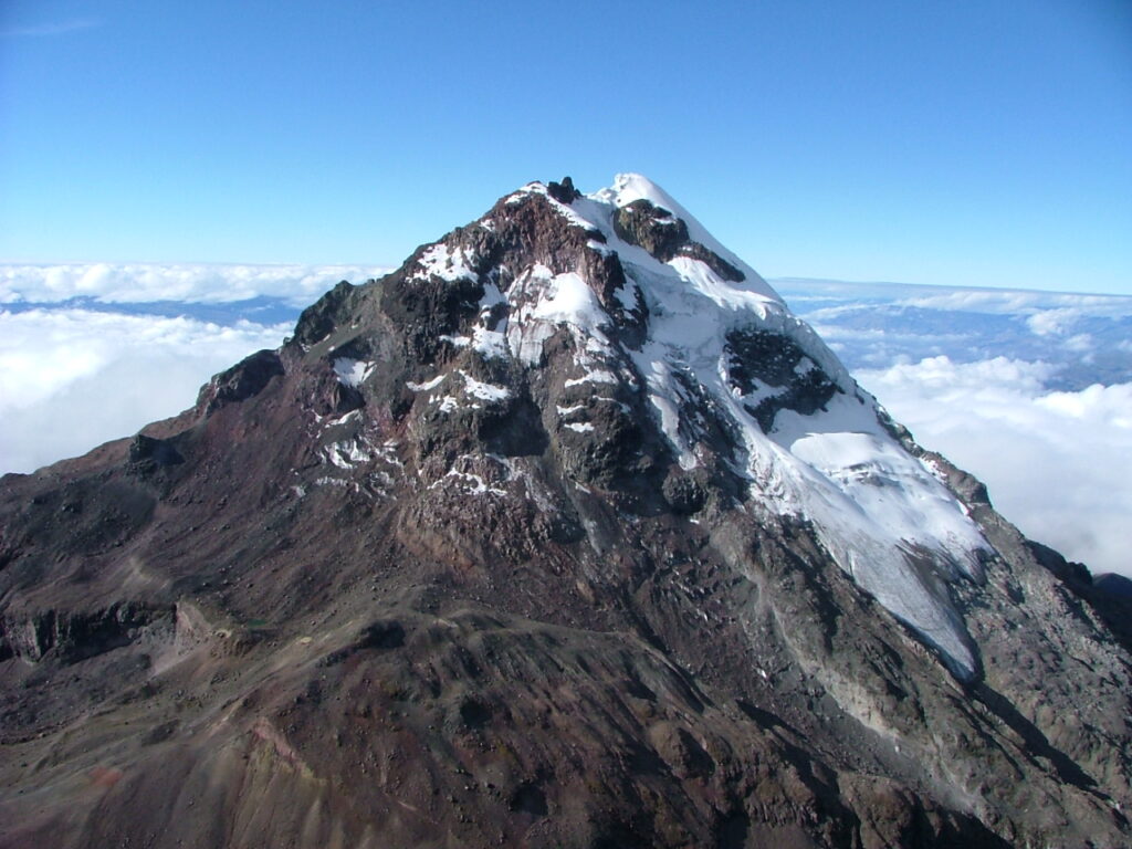
The Ilinizas, despite being plural, are actually two summits of the same volcano located in the Ecuadorian Andes. It is thought that they were once a single summit, but volcanic eruptions split it into two sharp peaks. The southern summit, standing at 5,263 metres above sea level, is higher and wider, and always covered in snow. That makes it a more challenging and technical ascent compared to the northern summit, which is at 5,125 metres above sea level and almost always without snow. Regardless of which summit you climb, reaching the top is a rewarding experience, offering breathtaking views of the surrounding landscape.
Corazón Volcano (4,788 m)
Corazón Volcano, named after its heart-like shape, is a majestic peak standing at 4,788 metres above sea level. Though it was once covered in snow year-round, today it only receives snow on particularly cold days and nights. Climbing Corazón volcano is relatively easy, and many experienced climbers use it as a way to acclimatise before ascending some of the higher, snow-capped peaks in the country, such as Cotopaxi, Cayambe, or Chimborazo.
Quilotoa lagoon and crater
Quilotoa lagoon, with its stunning emerald green waters, is a natural wonder located inside the caldera of the Quilotoa volcano. Though its waters are 250 metres deep and freezing, there are slight hot water currents due to volcanic activity. The minerals in the water give it its distinctive green hue, however they also prevent fish or amphibians from living there. Additionally, the water is unfit to drink due to volcanic gases. There is a viewpoint on the edge of the crater and another one in the community of Shalalá. The area also hosts a craft centre and various food and lodging services.
For those seeking a more immersive experience, there are several trails in the area that offer breathtaking views and stunning landscapes. The Quilotoa Lagoon trail is a 2-kilometre path that leads to the lagoon, which can be travelled on foot or on horseback. Visitors also have the option to rent a kayak to tour the lagoon. The 4-kilometre-long Yagual trail offers a journey through a forest of paper trees, natural viewpoints, and beautiful landscapes. It is of medium difficulty and ends in the La Edge sector. Finally, visitors can take a bus from the El Progreso sector to El Milagro, where they can rent vans that go to Cunuyacu. From there, visitors can take a 500-metre path that crosses a waterfall and leads to the thermal waters of a natural pool in the Termas de Cunuyacu.
Fancy a Tour in the Mountains? Check our options!